 Weird title huh? But ecstasy describes exactly what many of us longsuffering AC residents felt today when we FINALLY were able to simply drive over the newly completed Friendship Bridge. See the map below where it is circled in red to see where the bridge crosses the Abacan. What a treat to drive above the river bed without having to worry about waiting in line or breaking an axel in an extra deep washout. Zoom! I was across it in seconds where in the past it has taken as long as 20 or 30 minutes during rush hour when we had to wait in line to cross the "temporary" single lane bridge over huge rusted-out steel plates that clanged and jumped alarmingly as we drove over them.
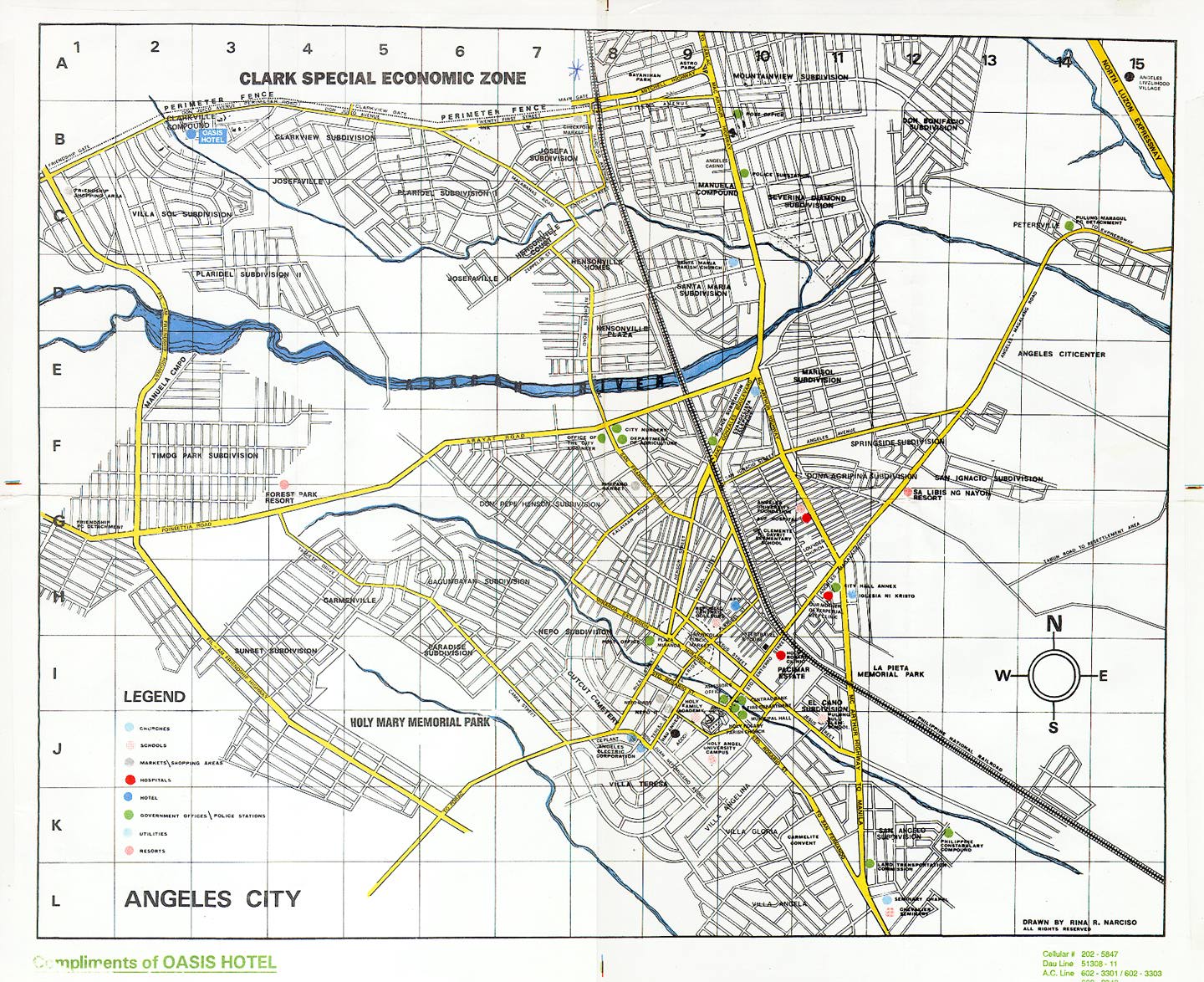 The Abacan River passes directly through Angeles City and it's outlying barrios from the east after originating from the slopes of the infamous Mount Pinatubo. Most folks familiar with the Philippines know all about what happened in June 1991 when that supposedly "extinct" volcano decided to revive itself and blow its top over much of this area. Massive amounts of volcanic dust and debris, called lahar, stacked up in huge slabs hundreds of feet thick on the slopes around the volcano. The storms of that rainy season and those of the next several rainy seasons washed gigantic chunks of lahar down into the Abacan river channel. The water mixed with the lahar to make a destructive slurry that washed away everything in its path, including all the bridges of Angeles City. The banks of the river also continually carved away the river bank, slicing away more and more real estate until the channel became hundreds of feet wide in places. Over the days and months, more and more homes and busineses disappeared into the brown angry river. It became more paste than water when the rains came down in torrents that lasted for days and weeks as they tend to do here in the tropics.
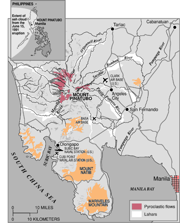 See the map above to see how Pinatubo is situated in relation to Angeles City. The river rushes down from the volcano's slopes, passes south of Clark Air Base and then forms the northern boundary of Angeles City proper. The very first bridge in it's path is Friendship Bridge and it has taken the full brunt and fury of its crushing rushing mounds of thick lahar mud.
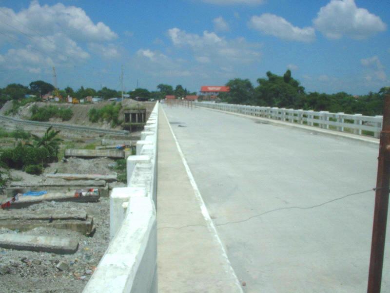 The above photo was taken on 26 Sep 06 from the south side of the new bridge before it was open. On the left side of it can be seen what's left of the original bridge. I believe they left the old pilings in place just to the west of the new bridge to help protect it from future lahar flows. I'm told that there are still millions of tons of the stuff waiting to wash down on us. Oh joy!
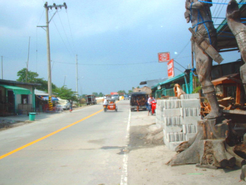 I took the shot above just today. This is the southern approach with the bridge directly ahead just a hundred or so meters. There is a woodcarving workshop to the right where I snapped the photo. Some of their creations are visible in the shot.
 This photo (above) was also taken today, 7 Oct 06, from the southern "on ramp." This ramp, a good 20 feet high at its tallest, did not exist until about a year ago when scores of dumptrunks hauled in tons of fill to create it. The riverbed has become so wide here that the only way to bridge it is to bring in more and more earth and hope that it won't just wash out around the ends of it. That's how the last two bridges on that spot were lost. That, and a bad case of under-engineering based on "under-funding," which I've heard happened because of "funds skimming." It's only rumor, mind you, so it might be true or not. But, if I had to bet...!
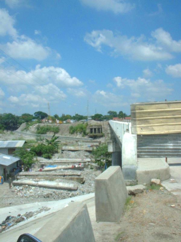
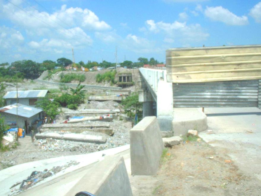 These are more views (above) of the vestiges of the previous bridge; you can see it's "bones" lying in the channel, which is mostly dry, even throughout the rainy season. It takes many days of hard steady rain for the channel to fill with water from bank to bank. I've only seen that happen once or twice in the four plus years I've lived here.
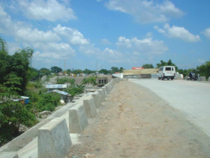 Another view like the ones above, only taken from near the beginning of the southern ramp looking toward the unopened new bridge with the broken pieces of the old bridge to it's western side in the distance.
 I took the pic above and the three that follow over the last couple of weeks. They show stills of the finishing touches being done on the north side approach and onramp. It may not be obvious in the picture, but the ramp curves around to the right as it approaches the bridge from the north. That's why the presence of the heavy-duty reinforced concrete traffic "teeth," to prevent vehicles from plowing off the ramp and possibly into homes or people.
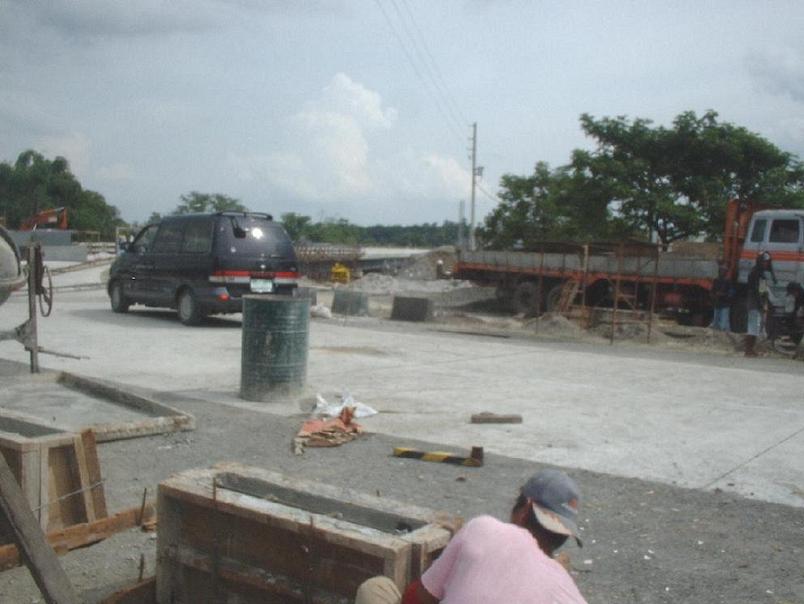 The entire north side was completed in just over one month. The bridge was closed completely to traffic on 21 Aug 06 to let the construction crews go at it unhindered. It has been a horrible inconvenience for those of us on the "wrong" side of the river.
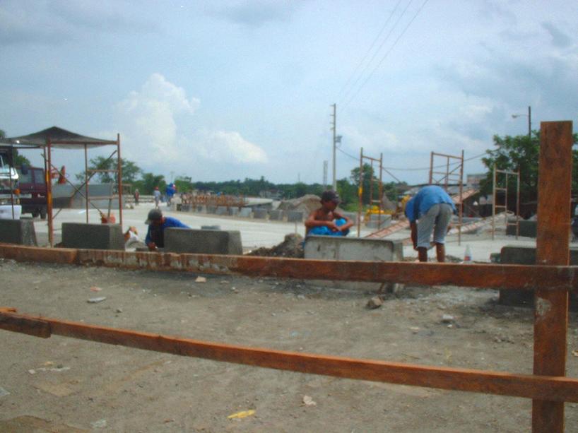
My daughter's school and my gym are just across the bridge and used to take just 5 minutes to get there. Suddenly, we had to drive all the way around to the next bridge in Hensonville, which added at times 20 or 30 minutes to the drive depending on the traffic.
 The guys above stopped for a moment when I asked them to wave and smile. It reminded me again how sweet the people of this country are. In the US, if I'd have asked some construction types to pose and smile for a photo, more than likely I would have been told to go to hell, or worse.
 This photo (above) was taken today of the mostly finished north side approach and ramp. The construction crane is still there, although its need is long past. It has been almost two years since this bridge was started. We had high hopes when the pilings were first put in all those many months ago that we would soon have a REAL bridge to cross that cursed river. None of us dreamed that it would take all this time to finish. ONLY in the Philippines!
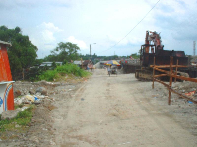
12 comments:
Yeah Phil, I'm dismayed too at the quality and tardiness in bridge construction in this country. The press says that the president has a special fund from her own budget for this. That explains why so many bridges have the neatly stenciled sign saying "GMA cares". Your neighborhood's new bridge might have that as well really soon. I see off and on comments in the press about that bridge in San Fernando, Pampanga's capital city. People complain about the noise and apparently fragile construction. For years traffic going on the Manila to Olongapo highway got tied up at the crossing with the north-south MacArthur highway. Always a mess there. Then suddenly there appeared a new bridge overpassing that traffic. And it was done in less than a two week period. Absolutely amazing! It's one of those steel girder and bolt types. . . and yes there is some rattle as traffic passes over. But it's a bridge! And apparently a good one too! I assumed when I first saw it that it was a temp but it's been there now about two years. There are a lot more bottlenecks like that in this country . . and they need bridges too.
I was no longer there when Mt. Pinatubo erupted. I didn't realize until now how close it is to Angeles City. Just shows you how much I know of Philippine geography.
Anon, lack of bridges is not for lack of engineers, or maybe it is. I've met lots of good Filipino engineers OUTSIDE of the Phils, but the real issue here is ALWAYS funding. I've heard the practise of skimming takes up a lot of it. It's a shame, because without infrasctructure the economy cannot grow the way it could.
Hiya Nice, Angeles and Clark are almost one in the same place. There's a good chance that the Americans may have not left if not for the Pinatubo eruption. In fact, the closest large city to Pinatubo is AC; and Clark and AC are built on top of old pyroclastic flows from Pinatubo eruptions that occurred thousands of years ago. Oh and Nice, there will be a quiz on this information next week! chuckle....
hi, quite unrelated, but i like the comprehensive way you write and bring perspective to issues. mind a link-up? i've added you to my site. :)
Hi Gibbs, link-ups are cool. After all, reaching out and connecting with others is what we do, yes?
My goodness! A lot of residents must've rejoiced that it was finally completed.
I didn't realize that I had passed by fairly close to you this Christmas. When passing through Angles City on our way to Oolongapo, I remember going over the temporary bridge with rusty steel planks that rattled like crazy and over the axle busting bypass. I was flew out of Manila the very next day.
Yup Ed, or is it Desert Rat, that was the Friendship Bridge. You went the back way to Subic effectively bypassing much of the worst AC traffic on MacArthur Blvd, smart move by your driver.
Me E,I think after all the years of waiting and suffering most of us just felt exhausted relief.
I think Desert Rat is a no holds barred, more emotional, throw everything to the wind kind of debater. I'm more cautious and try to use more provable facts.
Can you see the stress crack in your first picture? Without expansion joints cracks like this will continue to happen.
As you know Jim, if you want projects that are "under-engineered," THIS is the place to be... sigh!
Post a Comment